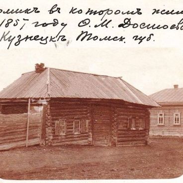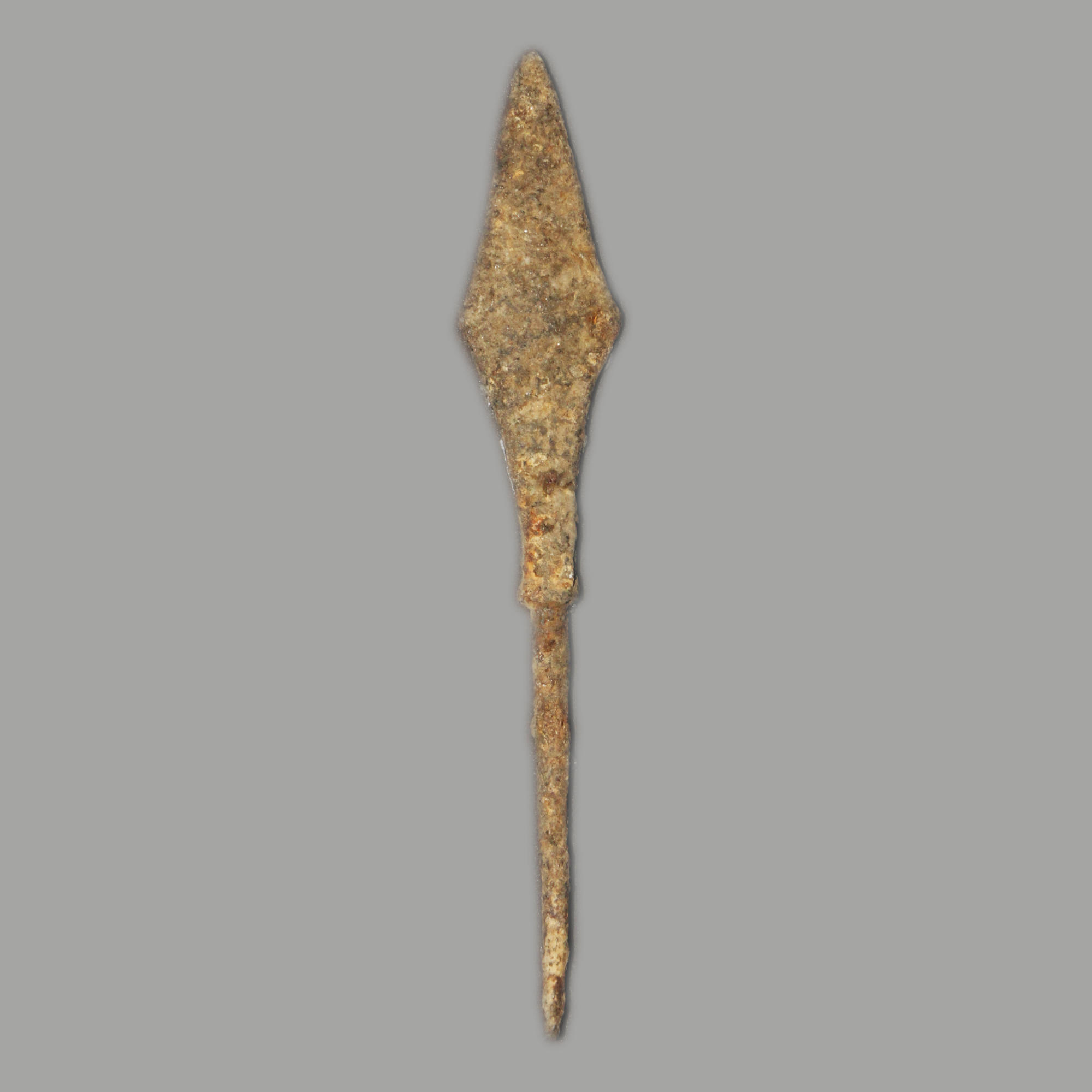
In 1986, Novokuznetsk historian Yuri Shirin took part in excavations on the territory of Ilyinka-5 archaeological site. There, he discovered the remains of a burned-out house with a clay adobe stove, as well as several fragments of ceramics and iron articles that included the arrowhead presented on display.
Ilyinka-5 is located three kilometers from the village of Ilyinskoye, not far from Novokuznetsk. The site is on the left bank of the Tom River, on the third basement terrace, on the right estuary slope of a dried-out stream. The total height of the terrace at this place is 35 meters.
Researchers found that a Russian settlement used to be located on the site of Ilyinka-5. On the Siberian map made by the Russian cartographer Semyon Remezov in 1701, it was indicated as the village of Shabalina.
According to historical documents, this village was founded in the 17th century by the Tsar’s government officials from Kuznetsk.
In the 17th to early 18th centuries, an explosive military and political situation formed on the southern Siberian border of Russia. The city of Kuznetsk, a powerful stronghold and the southernmost Russian fortress of Western Siberia at the time, was constantly attacked by nomads, in particular Dzungars, who were often called “Black Kalmyks”. The Dzungarian Khanate waged a fierce struggle with Russia over South Siberia; its troops regularly ravaged the Russian prisons and destroyed the fortifications. In the 1710s, several fierce battles took place between the Kuznetsk militia and the Dzungars. The village of Shabalina was in the war zone and burned to the ground. Finally, the Dzhungar army retreated from Kuznetsk and went to the banks of Irtysh.
The arrowhead presented on display has a flat and lozenge-shaped shape. Researchers believe that arrows with similar heads could be used by both Russian troops and nomads in times of old.
The bow that was the main offensive weapon of the South Siberian nomads in the Middle Ages. Its striking power was extremely great. For example, an arrow shot from a composite bow could pierce even dense chain armor from a distance of 75 to 100 meters.