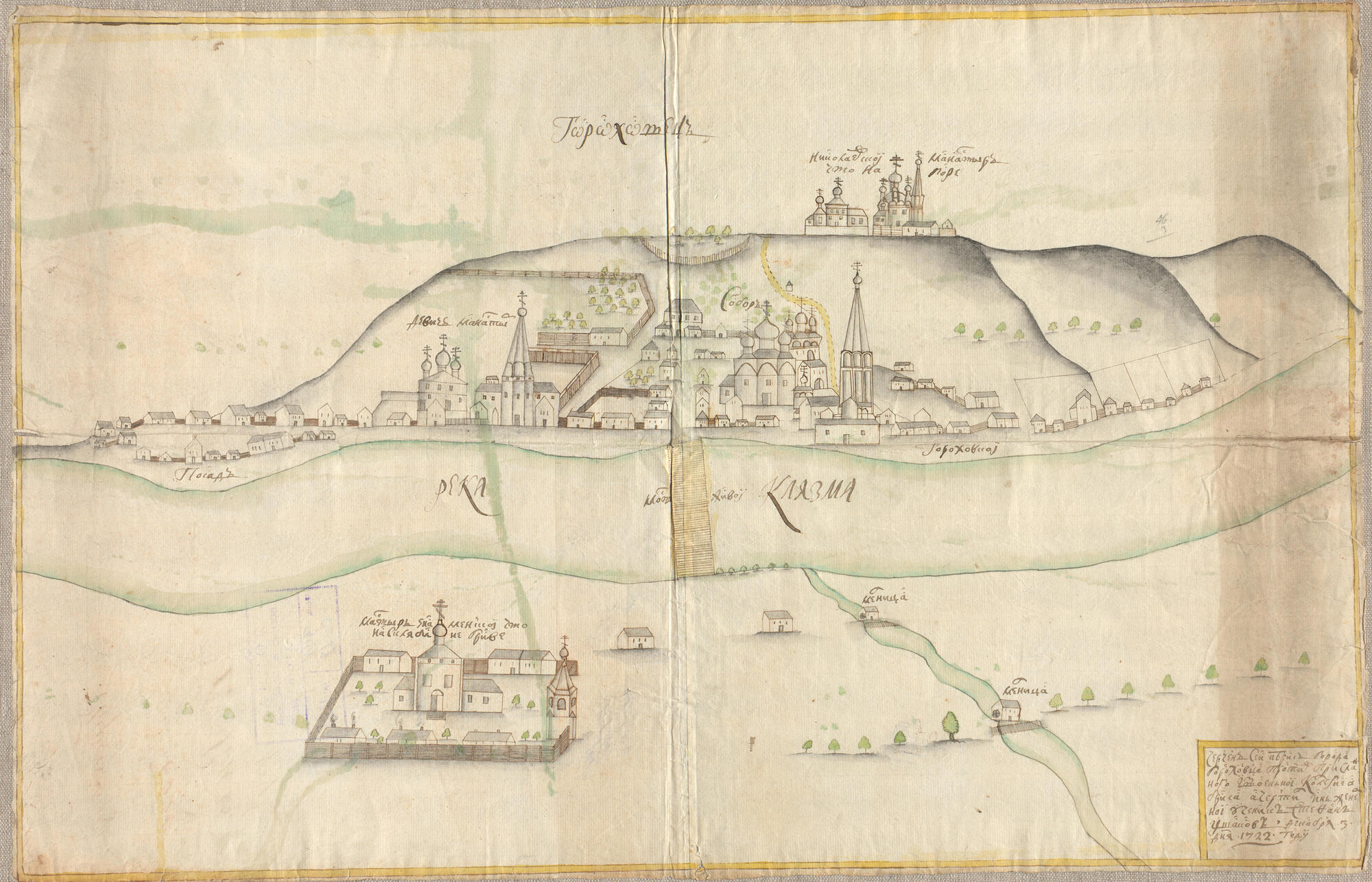
The museum’s collection houses the first plan of Gorokhovets dated 1722. It depicts what the town looked like during the period of extensive stone construction. This document belongs to the type of the so-called Russian geographical sketches of the 16th century — the early 18th century.
Such drawings were executed in a peculiar manner: they lacked orientation and did not provide a single scale of the surface area or a coordinate grid, clear spatial references, or strict geometric mapping. Also, the objects’ proportions were inaccurate.
Nevertheless, the document still recorded the qualitative characteristics of the territory and also reflected the layout of the volumetric-spatial composition of the town and the structure of its main roads.
This mapping document features the image of the territory of Gorokhovets placed in the upper part of the drawing, as well as the Klyazma River and the lands on the opposite bank — in the central and lower parts respectively.
The focal points of this image are the topographical elements, depicted in a plan view: the Klyazma River, the Veliky source, the only street in the town called Bolshaya Proyezzhaya, as well as a bridge over the river.
The territories of the monasteries and the central town square are shown in a simplified perspective view, and the facades of the buildings are depicted in a flattened manner. The church buildings have one facade, while the dwellings have two — longitudinal and gable.
At the same time, the dwellings are executed in an extremely schematic way: the drawing does not reflect either the number of stories or the size of the buildings. The images of church buildings, however, render most of their peculiarities and details: they convey the layout of facade systems, the number of stories, the refectory, the number of domes, the shape of the roof, and the ordinance.
The creators of the image did not use separate techniques for depicting different building materials. Both stone and wooden structures, except for the fences, are shown in the same way — with ink contours and gray roofs.

